SIGIS 2
Reliable Remote Gas Sensing and Imaging Proven in the Field
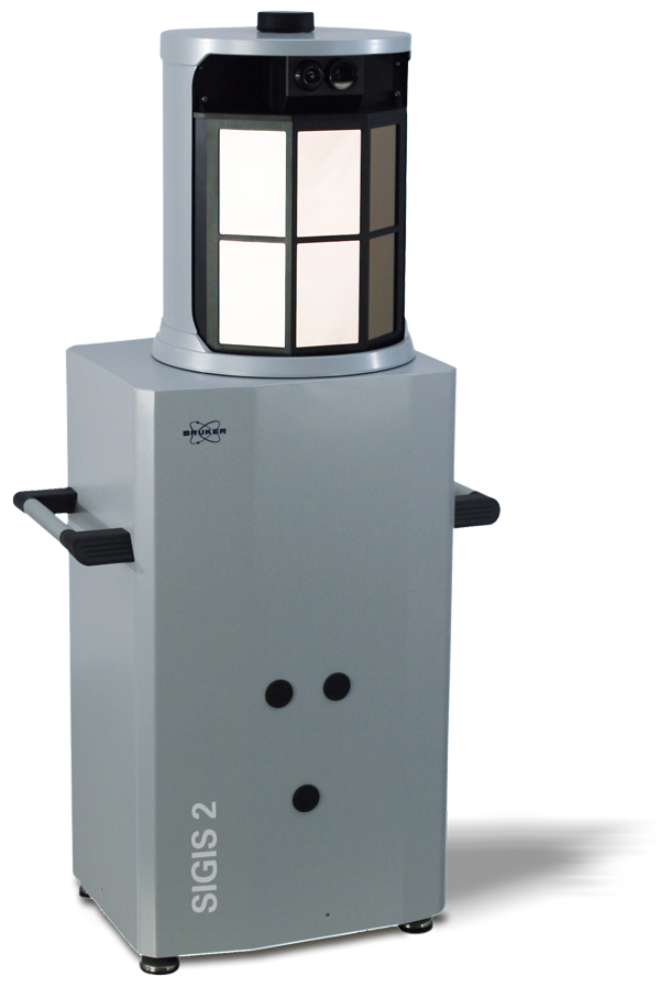
SIGIS 2 is a remote gas sensing system based on the combination of an FT-IR spectrometer and a scanning system for chemical imaging. It allows automatic identification, quantification and visualization of gas clouds which can be located even several kilometers away from the system.
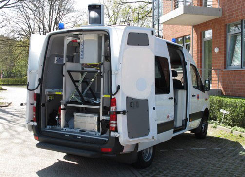
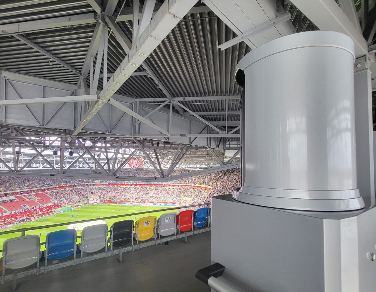
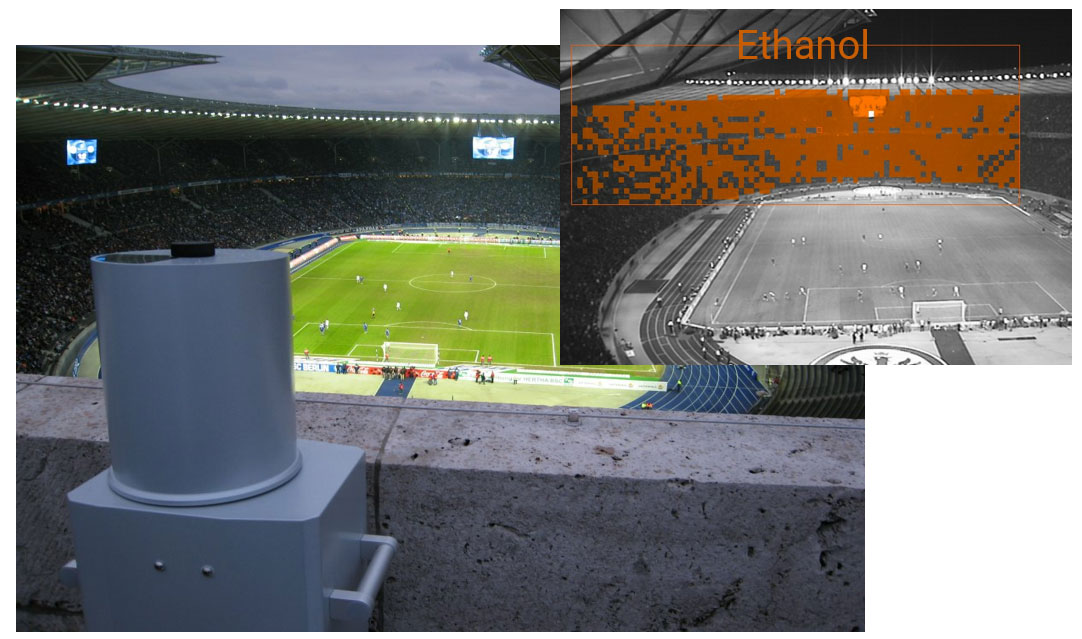
SIGIS 2 provides reliable information to users. For more than 10 years, SIGIS 2 has been deployed by first responders around the world to handle chemical accidents and monitor high-profile political and sporting events. SIGIS 2 has been used at Soccer World Cups, European Soccer Championships, Olympic Games, Ice hockey World Championships, NATO summits, and G20 summits. SIGIS 2 are also used worldwide for 24/7 industrial monitoring to provide users immediate warning and critical information should a chemical accident occur.
Free to Measure in Any Direction
SIGIS 2 uses thermal radiation emitted from background objects behind the gas clouds or from the gas compounds themselves as the light source for measuring the absorption or emission spectra of the target compounds. Therefore, SIGIS 2 is a so-called passive remote sensing system which does not need any artificial light sources or reflecting surfaces. This, coupled with its rotating head (± 180°) which allows for 360° surveillance, allows the user to measure in any horizontal direction they choose.
Gas Imaging by Fast Scanning
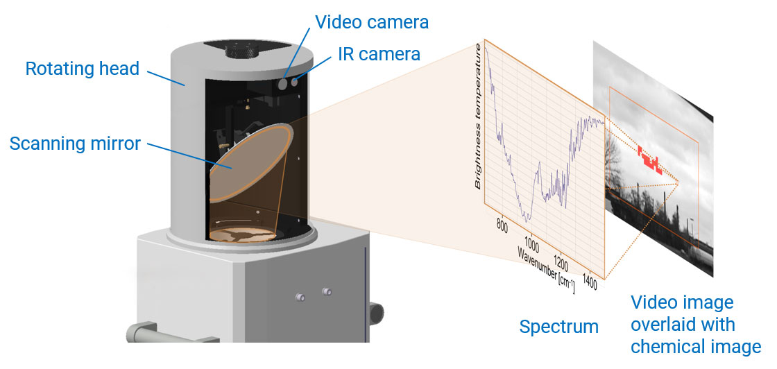
SIGIS 2 generates the chemical image of scanned gas clouds in a unique way. A mirror in the head of SIGIS 2 can rapidly scan the user-selected area of interest to measure the thermal radiation spectrum of every spot in that region. This method of imaging is much faster than using a pan-tilt-head to move the entire spectrometer to measure in different directions. Using this method, SIGIS 2 can measure 16 spectra per second (i.e., in 16 different spots of the scan area every second).
If compounds are identified in one or several spots in a scan area, the corresponding spots are color-coded to generate the chemical image of these compounds. By overlapping this chemical image onto the scene taken by the video or IR camera, the location and shape of the gas clouds are visualized in an intuitive way.
Ultra-High Sensitivity
The design of SIGIS 2 is optimized for emission measurements. It has high optical throughput and low noise which leads to low detection limits of target compounds. This ultra-high sensitivity enables SIGIS 2 to even identify gas clouds with concentrations of only a few ppm. Additionally, it enables the detection of gas clouds even when located over 5 km away from the system.
Dedicated Software and Large Library
SIGIS 2 uses the dedicated software OPUS RS/S to control the system, perform measurements, and analyze the data automatically. The software is easy-to-use and optimized for quick handling in emergency situations. No calibration to target gas is necessary, and the radiometric calibration and compensation of atmospheric gases are performed automatically. It is not necessary to perform any background measurement.
The standard library of SIGIS 2 contains more than 40 compounds for real-time identification. Additionally, Bruker offers an optional extended library of more than 400 compounds for spectral library search during post-analysis.
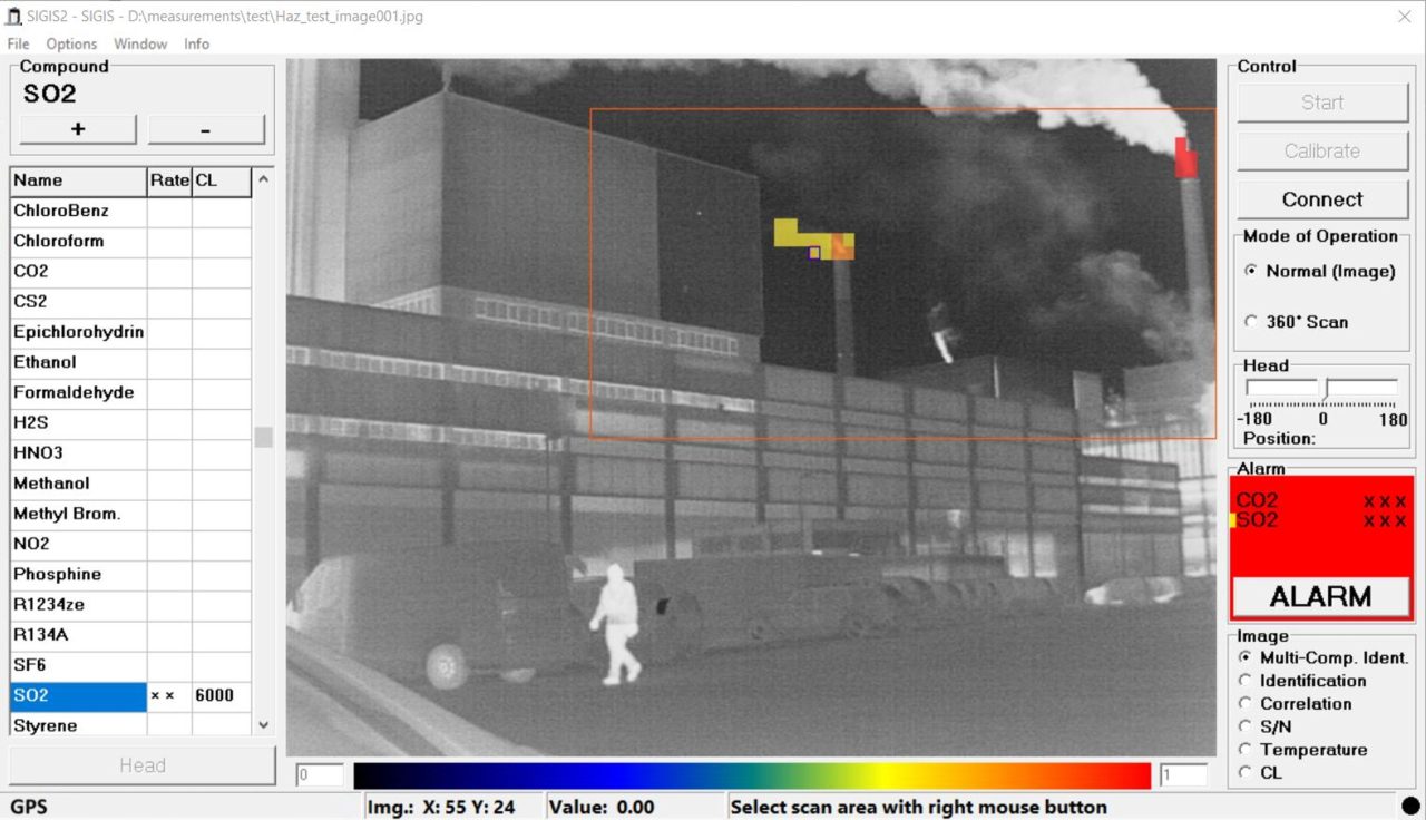
In this example CO2 and SO2 clouds emitted from two smokestacks are identified and visualized.
Prepared for 24/7 Industrial Monitoring
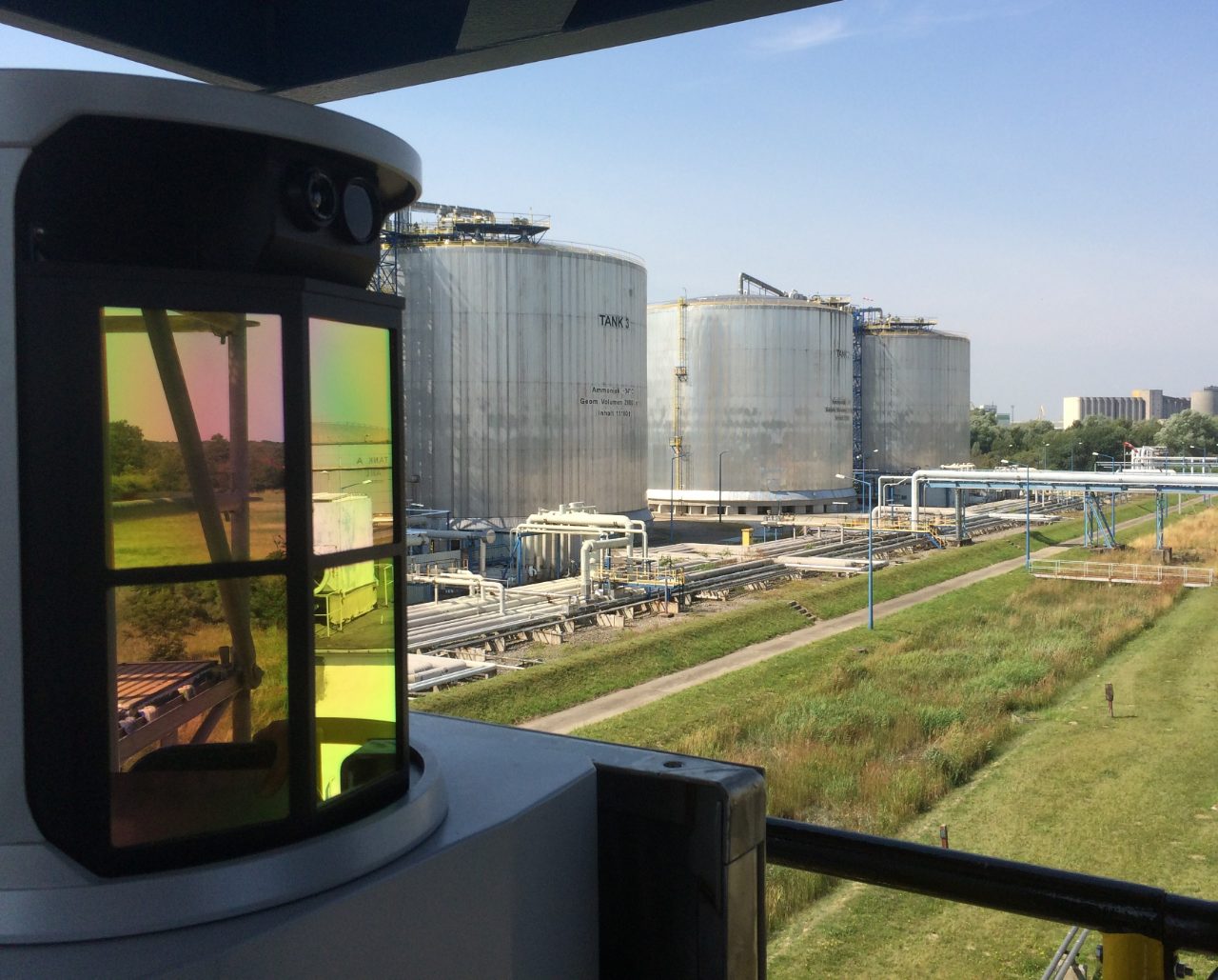
SIGIS 2 is also perfectly suited for 24/7 monitoring at industrial sites to give early warning in case of a chemical accident or accidental release of a dangerous gas compound. The remote sensing software OPUS RS/S offers a programmable mode to automatically cover multiple areas of interest in continuous operation. An additional web-interface can be used to exchange information with external software and supplemental measurement systems.
Pinpoint the Gas Cloud by Tomography
With the chemical image overlaid on the video image of the scene, the user can determine the two-dimensional location of the gas cloud.
However, with two interconnected SIGIS 2 and the tomography software module, the user can pinpoint the position of the gas cloud in 3D space and even reconstruct it as a 3D model. Such a model can be opened and visualized in a geographic information system, such as GoogleEarthTM.

Schematic drawing of two SIGIS 2 measuring the same gas cloud from two different angles to determine the position of the gas cloud in 3D space by performing tomography.
Sala de lectura sobre detección remota
Obtenga más información sobre nuestros productos y soluciones de teledetección descargando literatura relacionada.


